
Vilnius District Municipality: Castles, Technology and Nature
Accommodation in Vilnius District Municipality
In Vilnius District Municipality, defensive architecture, manor technology, regional culture and trails through protected landscapes sit side by side. When planning your trip, you can choose between castles and museums, crafts and hikes. The following places show different sides of the municipality—from the history of a manor to an exhibition of monumental sculptures.
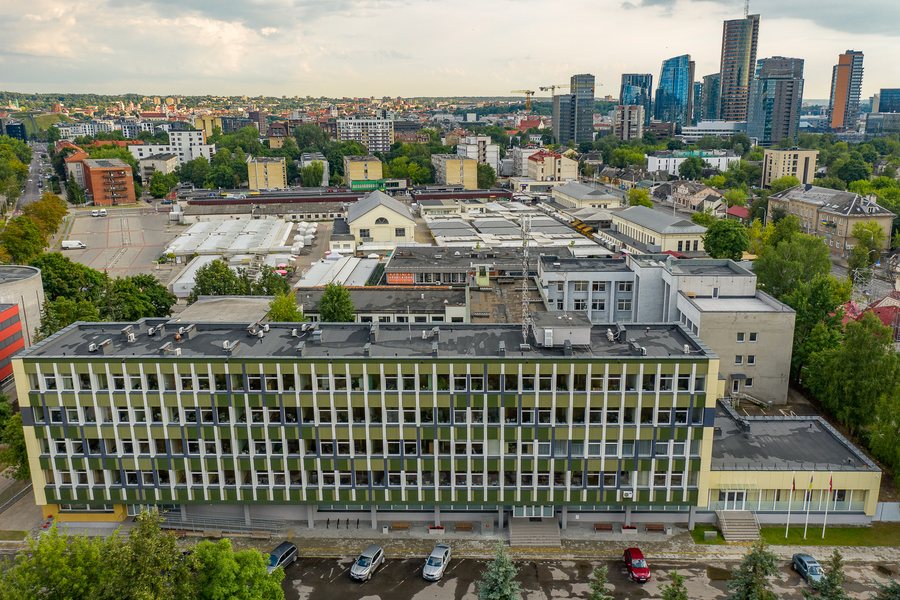 Vilnius District Municipality administration building
Photo: Augustas Didžgalvis via Wikimedia Commons, CC BY-SA 4.0
Vilnius District Municipality administration building
Photo: Augustas Didžgalvis via Wikimedia Commons, CC BY-SA 4.0
Key facts
- Medininkai Castle has four towers, defensive ditches and walls up to 15 metres high; its keep is about 30 metres high.
- Between 2010 and 2012, the castle underwent further restoration and was adapted for museum use.
- The Dūkštos Educational Trail is five kilometres long and physically challenging.
- Liubavas Manor is an outstanding example of architectural, landscape and technological heritage; its technological equipment has been fully restored.
- At the Liubavas Manor Mill Museum, visitors can see a historic watermill and more than ten production processes.
- More than 70 monumental granite sculptures can be seen in Vilnoja Sculpture Park, both in the landscape and in the lake.
- At Aukštojas Hill, visitors will find benches, a car park, bicycle racks, an observation tower and information boards.
- The Europos Geographical Centre is 26 kilometres north of Vilnius, between Purnuškės and Bernotai; visitors can obtain a visit certificate at the information centre.
Castles and the history of technology
The dimensions of Medininkai Castle make its defensive architecture tangible: four towers and defensive ditches form part of a complex with walls 1.8 to 1.9 metres thick and up to 15 metres high. The main tower, or keep, is about 30 metres high. Between 2010 and 2012, the castle underwent further restoration and was adapted for museum use. Anyone interested in historic buildings will find specific dimensions here that help describe the complex.
Liubavas Manor offers a different combination of architecture and history. Its fully restored technological equipment includes a working water turbine that is a hundred years old. At the Liubavas Manor Mill Museum, visitors can see a historic watermill and more than ten other production processes, including woodworking and metalworking, fulling and electricity generation. The museum also tells the story of the manor and the processes and technologies once used there. The focus is therefore not only on individual machines, but also on their role in everyday working life in the past.
The Vladislavo Sirokomlė Museum is housed in the poet’s former study. On display are furniture, portraits, books and other personal belongings. Unlike Liubavas, with its focus on the history of technology, the museum turns its attention to one poet and the objects that belonged in his workspace.
Regional culture and crafts
The Vilnius Region Ethnographic Museum in Nemenčinė displays exhibits on the everyday life and customs of the residents of the Vilnius region. The museum also runs ceramics and weaving workshops. Opening hours and workshop dates may change, so check them before planning a visit.
The Čekoniškių kaimo verbų ir buities seklyčia focuses on the traditions, customs and culture of the Vilnius region. The exhibition includes especially typical verbos, as well as household items. The Centre of Traditional Crafts at Houvaltai Manor in Maišiagala also preserves the region’s traditions and old crafts, and offers special lessons. This gives you different ways to engage: regional everyday culture in the exhibitions, or traditional crafts and lessons at the centre.
Landscape, sculptures and trails
The Neris Regional Park lies within Vilnius District Municipality. The municipality also has eight geomorphological, two hydrographic, two botanical, two ornithological, one ichthyological, two telmological and three landscape reserves. The Dūkštos Educational Trail offers a specific way to include a hike in your travel plans: it is five kilometres long and physically challenging. When choosing a route, therefore, consider not only its length but also the stated physical demands.
More than 70 monumental granite sculptures are on display in Vilnoja Sculpture Park. In Vilnoja Stone Sculpture Park, sculptures are located both in the landscape and in the lake. Facilities for visitors at Aukštojas Hill include benches, a car park, bicycle racks, an observation tower and information boards. As facilities may change, check their current status before your visit.
Getting around and choosing accommodation
The Europos Geographical Centre is 26 kilometres north of Vilnius, in the direction of Molėtai and between the villages of Purnuškės and Bernotai. Visitors can obtain a certificate of their visit at the information centre; certificate arrangements may change, so it is advisable to check in advance. From Lazdėnai railway station, you can continue by bicycle or on foot along the tourist route on the left bank of the Neris. If you are considering travelling by train, check current services.
This keeps your accommodation search focused on the places and activities you actually want to include in your trip.
Discover more destinations: Zujūnai, Grigaičiai, Dūkštos, Skirlėnai, Gineitiškės, Verkšionys, Paberžė, Vilnius, Sudervė, Galgiai, Buivydiškės, Vilkiškės, Bildžiai.
For the broader travel overview: Vilnius County.

