
Discover Šilalė District Municipality
Accommodation in Šilalė District Municipality
Museums, a specially developed educational trail and a distinctive landscape give Šilalė District Municipality its varied character. When planning your trip, it is worth first choosing the themes that interest you most: history and regional culture, outdoor activities or a specific visit, such as tasting lavender tea at Paulikų levandų idilė. The following places offer concrete options; some activities require prior arrangements.
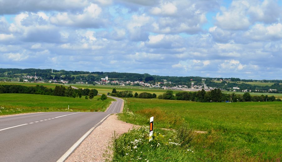 Žemaičių road near Kaltinėnai, Šilalė District
Photo: Šarūnas Šimkus via Wikimedia Commons, Public domain
Žemaičių road near Kaltinėnai, Šilalė District
Photo: Šarūnas Šimkus via Wikimedia Commons, Public domain
Key facts
- The Sietuvos kūlgrinda is a 2 km educational trail and is considered the only kūlgrinda in Lithuania developed for visitors.
- The Upynos ethnographic museum preserves around 3,500 ethnographic exhibits from Upyna and the surrounding areas.
- The Dionizo Poškos Baubliai Museum was founded in 1812 and is considered the oldest museum in Lithuania.
- Paršežeris is a lake of national importance, covering 193.4 hectares.
- The Jūra River flows through the territory of Šilalė District Municipality.
- The Gėliūkis farm has a seven-turn flower labyrinth and offers self-discovery activities.
- The Aukštagirė ski slope is next to the Aukštagirė observation tower.
Museums and regional history
At the Upynos ethnographic museum, the collection is presented in an unusual setting: a former parish barn. Numerous metal crosses, pole crosses and small chapels are displayed on the barn’s exterior walls. Together with around 3,500 exhibits from Upyna and the surrounding areas, they offer insights into different aspects of regional ethnography. Visits and guided tours must be arranged in advance, so be sure to plan your visit ahead of time.
The Dionizo Poškos Baubliai Museum presents a different kind of museum: it is housed inside the trunks of thousand-year-old oak trees. Its founding in 1812 and its status as Lithuania’s oldest museum make it a notable destination for anyone interested in the country’s museum history. Lembas is also the birthplace of Kazimieras Jaunius, a Catholic cleric and researcher of the Lithuanian language.
A shelter was built in 2024 at the Stasio Girėno birthplace museum for Vlado Kensgaila’s model of the “Lituanica,” made to a 1:2 scale. If seeing the model is important to your visit, check how it is currently displayed in advance. This lets you plan your museum visit around a specific historical object.
Educational trail, lake and activities
The Sietuvos kūlgrinda combines a nature experience with a specific cultural history theme. The educational trail is 2 km long, and the kūlgrinda is considered the only one of its kind in Lithuania developed for visitors. This makes it a clear option if you would like to combine a walk with a distinctive regional connection.
Bodies of water also shape the range of things to explore: the Jūra flows through the municipality, while Paršežeris, with an area of 193.4 hectares, is classified as a lake of national importance. The river and lake give the landscape distinct contours. Those interested in winter sports will find the Aukštagirė ski slope next to the Aukštagirė observation tower. Before your trip, check whether it will be open for use during your visit.
The Gėliūkis farm has a seven-turn flower labyrinth where self-discovery activities are held. If you would like to take part, check the program’s availability in advance. Paulikų levandų idilė adds a culinary touch with lavender tea to taste; check that this option is available before your visit as well.
Looking further afield in Tauragė County
Beyond the municipality, the wider destination of Tauragė County offers further nature and culture themes. Viešvilė State Nature Reserve is included in the Ramsar List of Wetlands of International Importance and the Natura 2000 ecological network. It protects the natural ecosystem of the Viešvilė River basin, including the Artosios and Gličio bogs and the surrounding forests of Karšuva Forest. This protected landscape is a distinct regional highlight within the county.
The visitor centre of Pagramantis Regional Park in Ringių features an exhibition titled “Almančios rėvos”; the centre is at the confluence of the Akmena and Jūra rivers. The Viešvilė Nature Reserve visitor centre in Eičių displays a 1,000-year-old bog profile. The exhibition also introduces Karšuva Forest, the Viešvilė stream that flows through it and the surrounding bogs. Visitors can also visit Lithuania’s only capercaillie breeding facility there; check access arrangements before your trip. For a broader look at regional history, the Ivangėnai (Karšuva) archaeological complex on the Suvirkštis River comprises two hill forts, a settlement at their foot and a burial ground.
For more location-specific information, see the pages for Laukuvos Eldership and Jomantai. Other destinations at the same broader administrative level include Jurbarkas District Municipality and Tauragė District Municipality.
For the wider travel overview: Tauragė County.

